 Rolling through Antigua this weekend was quite amazing. Even though the country of Guatemala is roughly the size of Ohio, it contains over 30 volcanoes, which are enormous. When I actually (more or less) reached the top of Fuego, I realized how drastic the country really is, in terms of geography. You drive from the busy, huge, smelly, metropolis of Guatemala City, hike a few hours up a mountain, and it seems as though you are in a completely different world.
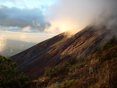
We were drenched and sweating as we hiked 5-6 hours up to the base camp (from 4,500 ft to 10,000 ft), surrounded by jungle trees. But up on top, another 1 ½ hrs and 2,300 ft later, it was windy, and freezing, completely barren. 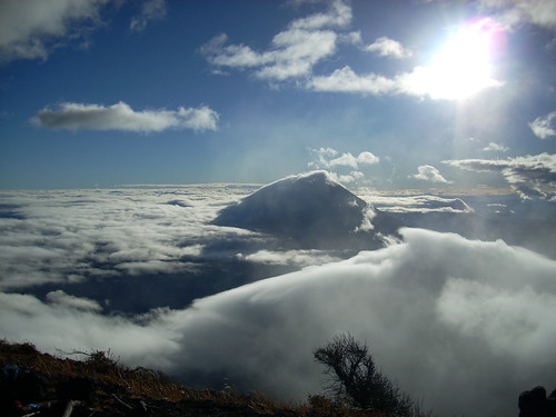 There was nothing growing. All I could see was rocks. However, looking out across the landscape, I was met with a wonderful sight. Colossal volcanoes, covered in clouds, towering over the rest of the valley. I have never seen anything as awesome. And that is only one small fraction of the country. There are dozens more volcanoes, mountains and ridges that cover the countryside.
If we compare this country to the United States, we have similar geography, with the same mountains, forests, and beaches. However, our country is 100 times the size, maybe larger. It’s amazing that so little a country can contain so much. This weekend taught me a lot about perception as well. The volcano, from distance, looked like a piece of cake to climb, but it challenged my limits as I struggled all the way to the top. Even from our campsite, the top seemed a short hop away, but boy was I wrong.